| View previous topic :: View next topic |
| Author |
Message |
washy
Joined: 25 Apr 2002
Posts: 8
|
 Posted: Mon Jul 25, 2022 6:48 pm Post subject: Posted: Mon Jul 25, 2022 6:48 pm Post subject: |
 |
|
| I have to agree that in the example given (wind map of the gorge) I too vastly prefer the old map. I can see in seconds what I care about. The new one I have to zoom in to declutter all the useless topography to see anything. The wind maps for sites showing the whole day (instead of the newer “live” map is easier for my brain to gauge what is happening based on years of looking at the same maps. It’s about simplicity, not clutter and advertisements.
|
|
| Back to top |
|
 |
windfind
Joined: 18 Mar 1997
Posts: 1905
|
| Posted: Tue Jul 26, 2022 9:24 am Post subject: |
|
|
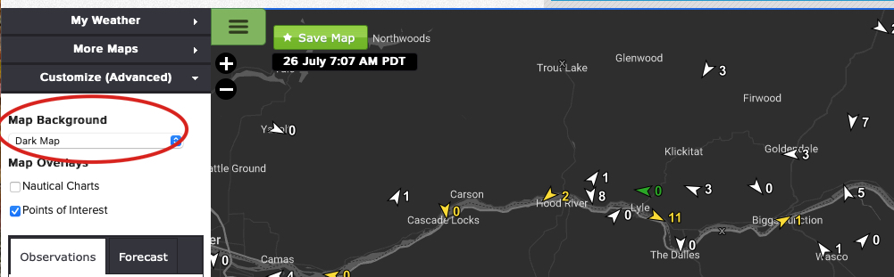
Then just remove all the clutter in the map:
https://wx.iwindsurf.com/map#45.133,-120.917,9,1 just of to Customize, then Map Background and select Dark Map.
or add satellite imagery to the map on a day when there is clouds in the corridor:
https://wx.iwindsurf.com/map#45.286,-123.701,9,240389
or if there are T storms that might move over your site add radar to the wind map:
https://wx.iwindsurf.com/map#45.286,-123.701,9,240429
The new windsurf is like a Swiss Army knife. If you just use one blade you are missing useful tools.
Here is the blade to use when you want to improve your odds of finding quality wind at Roos and The Wall: https://wx.iwindsurf.com/map#45.286,-123.701,9,240389
Mike Godsey
Weatherflow
| Description: |
|
| Filesize: |
136.4 KB |
| Viewed: |
3665 Time(s) |
|
|
|
| Back to top |
|
|
|
|
You cannot post new topics in this forum
You cannot reply to topics in this forum
You cannot edit your posts in this forum
You cannot delete your posts in this forum
You cannot vote in polls in this forum
You can attach files in this forum
You can download files in this forum
|
|
|

