| View previous topic :: View next topic |
| Author |
Message |
windfind
Joined: 18 Mar 1997
Posts: 1907
|
 Posted: Sun Jul 31, 2022 9:17 am Post subject: New imagery from dawn Monday: Monsoonal clouds! Posted: Sun Jul 31, 2022 9:17 am Post subject: New imagery from dawn Monday: Monsoonal clouds! |
 |
|
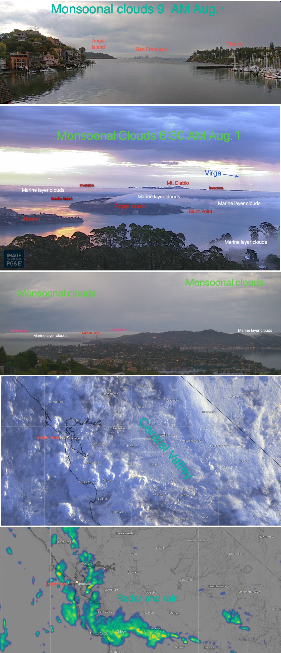
Hi Gang,
New imagery from dawn today of Monsoonal clouds covering the Bay Area and most of the west coast below:
https://blog.weatherflow.com/west-coast-wind-blog-monsoonal-clouds-bring-fire-risk-to-much-of-the-west-coast/
The upper high pressure at ≈18,000 feet that has brought a lingering heat wave to the west coast is also sweeping up moisture from the more tropical waters near Baja.
These clouds will weaken the pressure gradient to the Central Valley, Southern California Deserts and the Columbia Basin taking the edge off the wind at many launch sites in Southern California, San Francisco Bay Area and The Gorge.
Far more importantly, these clouds bring a risk of thunderstorms to the Cascades, Sierra and California coast range for the next few days, especially this afternoon.
Given the winds, during this heat wave and the very dry vegetation this is low confidence, yet potentially high impact forecast for fires for California and the Pacific Northwest.
For the Gorge the Cut-Off upper low to our west at ≈18,000 feet adds to the moisture and instability increasing the risk.
Mike Godsey
Weatherflow
| Description: |
|
| Filesize: |
656.54 KB |
| Viewed: |
3872 Time(s) |
|
|
|
| Back to top |
|
 |
|
|
You cannot post new topics in this forum
You cannot reply to topics in this forum
You cannot edit your posts in this forum
You cannot delete your posts in this forum
You cannot vote in polls in this forum
You can attach files in this forum
You can download files in this forum
|
|
|

